Sunday, August 31, 2008

A Looper Cook-out in Grand Haven

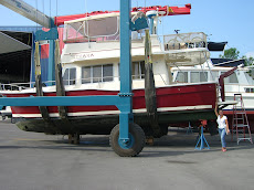
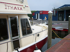
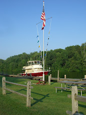
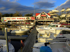
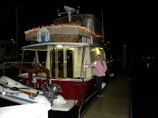
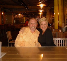
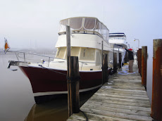
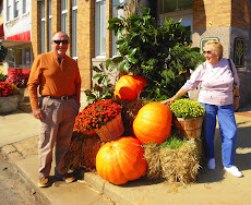
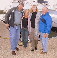
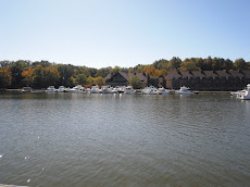
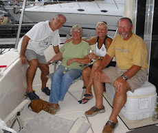
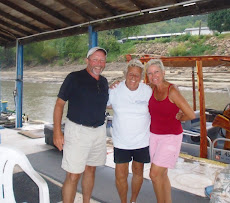
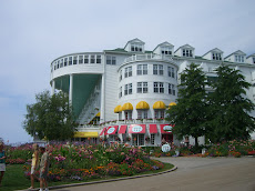
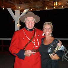
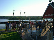
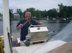
A few of the looper captains got together and decided to organize a cook-out here in Grand Haven since there are so many of us all together in one place! -And, afterall, it is Labor day weekend so a BBQ is pretty standard practice.
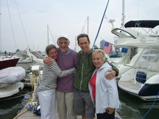
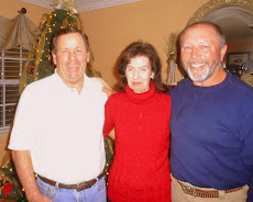
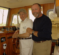
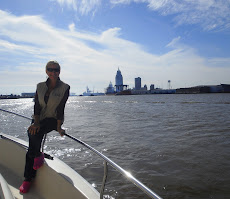
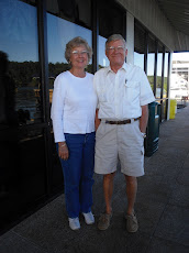
Those attending came from far and wide...one couple from Australia actually came to the states to buy a boat specifically to make this journey...they are cruising on Kiwi Explorer. Others at the party included our friends on Sunshine (Bud, Muriel and Shelly) from Mooresville North Carolina and Blue Max from Shelter Island New York (Captain Bill, Eileen and Clarissa)...Wanderin' L & M is from New York, too... oh yes, and C-Life from Southport North Carolina...Phantom of the Aqua from Ft Myers Florida and Bella Luna from Leesburg North Carolina...Etc. (that's the name of their boat...Etc.) and, full of grace: Grace-full...the biggest of us all: Victory & let's not forget Our Turn, too! (I hope I didn't miss anyone). It was a super gathering of fun folks all happy to share stories about this wet, wild and wonderful adventure. Someday I'll write a poem using all the names of the boats we have met along the way!
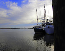
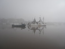
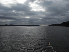
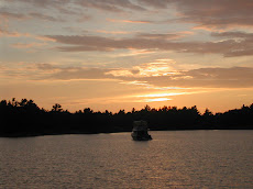
Not much longer before we hang up our boat hooks for the winter, but with so many of these loopers passing through Naples by the end of the year, we know we haven't seen the last of them!

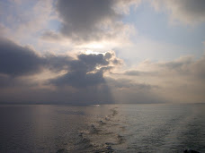
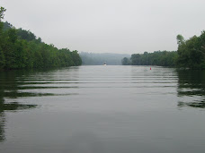
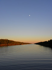
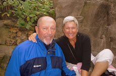
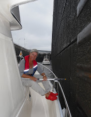
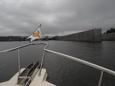
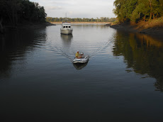
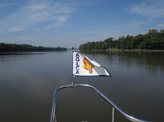
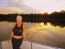
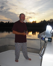
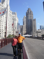
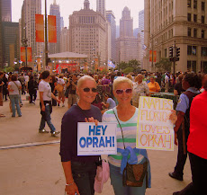
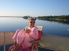
"A journey is best measured in friends, rather than miles."
Posted by Picasa

Friday, August 29, 2008

Life is a Beach


A few scenes of the lovely beach in Pentwater!
*Remember you can click on these to view them bigger!


Posted by Picasa

Good to the Last Drop!


On Monday we left Charlevoix Marina early to make the 7:30 am bridge opening. We travelled 35 miles to Leland in calm seas. We were all settled in by noon. We are so glad that we decided to make this one of our stops! Leland is a picturesque village, home to the historic "Fish Town". Commercial fishing began here in 1870. Today it is one of the few remaining fishing complexes left on the Great Lakes. The fish tugs are icons on the waterfront...one of the shops even specializes in art, clothing and accessories with the green and white tug "logo". All the waterfront shops and galleries and many of the restaurants are housed inside the rustic shanties which date back over 100 years...The opportunity to take photographs was unbelievable...at every turn another postcard! While on the docks we watched a fishing boat come in with salmon-after the captain filleted them, he tossed the carcasses over, and we were privy to a wonderful show put on by the local river otters who came out from under the docks to gather up the bones and scales...we watched them swim back and forth and finally they made their way to a group of rocks across the river where they feasted on their "catch"! By far, this was one of our favorite stops along the loop. (I will download photos as soon as I get to a place where my aircard gets a stronger signal)...
We got up early on Tuesday and headed to Manistee at first light. It was a glorious day to be on lake Michigan~a gentle breeze right out of the east; we enjoyed an entire day underway. We passed by Sleeping Bear National Park where for miles honey colored sand is swept up along the shore in dunes as high as 500 feet! We began to notice quite a few monarch butterflies...it seemed unusual as we were about 4 miles offshore, so later that night I decided to "google" Monarch Butterfly migration routes...Sure enough, we were right in the flight pattern for those which leave the Great lakes and head to Mexico this time of year. Unlike most other insects, Monarchs cannot survive a long cold winter so they spend their winter in roosting spots. Daylight and temperature changes influence their movement. In all the world, no butterfly migrates like the monarch of North America...up to 3000 miles. Amazingly they fly to the same winter roosts, often the exact same tree! They only make the round trip once. It is an unsolved mystery how they find their way each year...somehow they just know their way even though the butterflies returning south are the great-great grandchildren of those who returned north the previous spring. We arrived in Manistee in time to walk up and down the main street along the waterfront, eat a fabulous dinner out at the Tuscan Grill (reason alone to make this a stop)...and went back to Ithaka to call it an early night. Right beside us on the dock was a looper from Ft. Myers, Florida!
On Wednesday morning again we decided to take off early...and even though it was a beautiful day to be out on the water we wanted to stop to see the charming town of Pentwater. In fact, it was so charming, we stayed two nights! Pentwater welcomes you the moment you enter the harbor...ginger-bread trimmed cottages, brightly colored umbrellas and wind socks, and a dozen or more wonderful art galleries are just a few of the reasons we loved this town...a sparkling lake dotted with sail boats at anchor was our view from the top deck of Ithaka. We spent the afternoon at the beach where we found miles of soft sand, crystal clear water and more breathtaking dunes sculpted by the ever persistent winds off the big lake. We got back onboard around 8 pm...just in time to watch a perfect sunset...we sat upstairs drinking wine, listening to soft music and watched swans swim by...It could have been a scene from a movie. By the way, we are docked at Snug Harbor Marina and I highly recommend it! Our second day in Pentwater was a catch up day...cleaning and laundry, organizing and charting out the course for this, our last few days on Ithaka for the summer...We are going to live it to the fullest and enjoy Lake Michigan right down to the last drop!

Sunday, August 24, 2008

Sharing The Good Life


We had a nice visit with Chip's family. We went to a cocktail party here at the marina on Friday night and it was fun to introduce Gil and Pam to all the "loopers"...Then on Saturday we set off to explore the sights that surround the Charlevoix area. Gil was our driver and we headed to Harbor Springs in his convertible...With the radio cranked up we listened to the tunes and drove along the coast of Lake Michigan up through Petoskey to this sweet waterfront community...a real estate agent told us that a lot of the "cottages" command upwards of $10 million dollars! Many of the snowbirds in Naples come from this area. The harbor is pristine and there are dozens of sailboats dotting the bay at anchor between the downtown area and Harbor Point...plenty of shops and restaurants...an abundance of flowers, wrought iron benches, spinners and flags, bleached white church steeples...and of course, lots of fudge stores! I finally succumbed! On the way back to the marina we stopped at Bay Harbor, a prestigious new community about 10 minutes from town. I don't believe I have ever seen this many mega-yachts outside of Fort Lauderdale! Wow!
On Saturday night we enjoyed raw oysters at a local Charlevoix pub then back to Ithaka where the 3 Harris' tried in vain to teach me how to play Euchre...(they play cards funny in Canada)...give me a good game of hearts or rummy anyday! I told them I would "google" euchre strategies and would be ready for them next time! I have already been scanning the web and found http://www.gamesinfodepot.com/ to be quite helpful!
Today we walked around the town after breakfast and found the Earl Young homes...He was a real estate agent and builder here in Charlevoix many years ago, who with no formal training in either construction or architecture, left his mark in Charlevoix. His small stature combined with his fascination with Frank Lloyd Wright led him to design the "mushroom"-like homes...Looks like the kind of cottages you would see in movies about trolls or smurfs! Some of the chimneys had morter "running" down them like icing on a cupcake. I looked him up on the internet and his story is very interesting.
After Gil and Pam left we walked around the marina and found two boats from Naples! No kidding...small world!
Tomorrow we continue our trek south. We love this area...it is so beautiful...I could spend an entire summer up here...you just cannot see it all in a couple of weeks!
We had a great time in Charlevoix, sharing the good life...Euchre anyone?

Friday, August 22, 2008

I knew you were coming so I baked a cake!


We spent a couple of peaceful nights in Petoskey (after the rolling in the Mackinac Island marina anything would have been better). Petoskey has a great downtown within walking distance from the marina. The waterfront park is lovely and the bikepaths are wonderful! The "crew" from Sunshine: Bud, Muriel and Shelly, joined us one day as we explored the quaint shops and ate lunch together at The City Grill. The flowers in Petoskey are beautiful. We miss the "crew" from The Blue Max already...they ventured on past us, but as is often the case on this trip, we keep catching up to or passing by familiar loopers at every stop. One of the best parts of this trip has been the friendships we have made...the companionship with fellow loopers, folks all sharing the same dream...It really is amazing how many loopers we have met this summer. During last year's leg of the trip we ran into so few loopers, but we realize it was mainly because we pulled out of Naples about 30 days behind the more usual timeframe that the Great Loop guide recommends...This year however, we are right in speed with about a dozen or more loopers and we cross each others wakes often...I always get a kick out of seeing that burgee flying from a distance, then looking to see where their boat is from. Right now there is a couple from Ft. Myers in the pack!


Anyway, we arrived in Charleviox yesterday and this morning we are getting ready for our company: Gil (Chip's favorite brother) and wife, Pam! They are driving up from Clarkston Michigan to spend the weekend with us and we are so excited that we ended up in such a cute town for their visit. The marina is fabulous...close to everything, located on Round Lake, a short river ride in from Lake Michigan. We took the dinghy out to Lake Charleviox yesterday, but decided to wait for Gil and Pam check it out further...There are so many amazing antique wooden boats here...and a "pirate" ship, several mega yachts and sailboats and trawlers of every size, make and color! (Ithaka is the only red boat in the marina, which is not unusual)...She always stands out even when docked next to one of the "big girls"!


Well, I better get going...I've got a cake in the oven!

Wednesday, August 20, 2008

The original Big Mac!

My cautious captain left Mackinac Island yesterday morning in spite of the white caps which he viewed from the flybridge with his binoculars looking out towards the straits...we decided, with the prevailing east wind, it wouldn't be so bad after we got out and headed south into Lake Michigan-- and that it was a better travel day than waiting for today. So, here we are in Petoskey...I thought I would post a few pix of the bridge. The Mackinac Bridge is the 12th largest bridge in the world with a span of 3,800 feet. It was opened in 1957.


Monday, August 18, 2008

Oh Fudge!


In 1634, only 14 short years after the Pilgrims landed on Plymouth Rock, Jean Nicolet, a French adventurer exploring on behalf of Samuel de Champlain-the governor of Canada, paddled his canoe through the Straits of Mackinac. I personally find this accomplishment quite extraordinary considering the distance and elements he had to overcome to find his way west. In the early years Mackinac Island was home to the Jesuits, including Father Jacques Marquette in 1671 and a British outpost where English Major Patrick Sinclair choose the site for his Fort Mackinac in 1780 (the photo inset is a view from the fort down to the harbor-remember you can click on these photos to make them larger...look closely and see if you can find Ithaka). It was also the western most fur trading outpost, John Jacob Astor's American Fur Trading Company was centered here and produced beaver pelts for over 30 years...in 1815 the island was restored again to the Americans by way of a treaty. Mackinac Island is located in Lake Huron (not Lake Michigan). From here we will travel to Petoskey and begin our voyage down the east coast of Lake Michigan where we will find boater friendly towns all along the coast on our way to Chicago.

While here on Mackinac Island we did all the "touristy" things one can do, including a Horse and Carriage Ride, which pointed out all the highlights of the island: A tour of the fort, the Arch Rock, and a visit to the beautiful Wings of Mackinac: a butterfly conservatory...and of course, The Grand Hotel, where one of my all time favorite movies was filmed: Somewhere In Time with Christopher Reeve and Jane Seymour. (If you have never heard the movie soundtrack, you must make a point to listen to it next chance you get!) We had an amazing meal at The Carriage House at Hotel Iroquois (the scallops were perfect)...afterwards we went up to The Grand Hotel and had a nightcap at The Canopy Room on the top floor and strolled on the world famous veranda...For lots of fun and a really yummy rum runner we highly recommend The Pink Pony (a great view from the patio, too)...good buys for cheap t-shirts and that sort of stuff at The Big Store...and of course, I cannot include a blog entry about Mackinac Island without mentioning the fudge! There are 17 fudge establishments operating on the small island...just about everywhere you go on Mackinac you cannot escape the smell of fudge...and horse manure. Oh fudge!

Today we got on our bikes and Brandy joined us for a ride around the entire perimeter of the island: eight miles on Michigan State Road 185. There were hundreds of cyclists, but no cars! (they aren't allowed on the island). It was a great ride even though we got caught in the rain. I could not get over how clear and blue the water is here...like the Florida keys, seriously. We stopped at Saint Anne's church on our way back into town. It which was transported to the island in 1780 across the straights on the ice. It was relocated to its present site in 1820 and remodeled in 1873. The stained glass windows were installed in 1900...they're beautiful. Mackinac Island's name was derived from a Native American Indian word for turtle and there are turtle sculptures all over the island! Today it continues to be a very popular tourist resort. 80 % of the island is a state park and the entire island is a National Historic Landmark. We are so happy that we made this stop part of our trip. It is certainly a treasure.

A Familiar Face

We arrived on Mackinac Island on Saturday after a bouncy 35 mile run from Drummond Island where we had gone through customs the day before- Our "daughter" Brandy, Leonardo's mommy (she is on Mackinac working for the summer) was on the dock waving as we came through the breakwalls. By travelling directly to Mackinac Island, rather than Mackinaw City or Saint Ignace (both on the mainland and reachable by ferry) we took a chance. Because it is a state park, reservations are made in advance (especially for a weekend in August), and made on the internet...as you know, our service has been sporatic plus when travelling by boat it is difficult to determine when exactly you will arrive at specific destinations so, when we did finally try to make reservations we were told they were "full"!
Well, with a little prayer and a whole lot of positive thinking we did something we haven't done before: arrive at a port without a reservation-somehow I just knew they'd have a slip for us. We were put on a "waiting list"...we tied up to a gas dock long enough to get Brandy onboard, then proceeded to circle the harbor for about 30 minutes when a voice on the radio called, "Ithaka, this is the Mackinac Island State Harbormaster and we have a slip for you!" Yahoo! I'll write more soon to fill you in on all the fabulous things we are doing on this wonderful island! Till then, we're off to explore!
Posted by Picasa

Thursday, August 14, 2008

Thank you Canada!


Tonight we are spending the night at the most northern point of the entire Great Loop; Blind River, Ontario. Tomorrow we head to Drummond Island and go through customs, then onto Mackinac Island for the weekend. We will be cruising down the east coast of Michigan and look forward to the next few weeks of our trip before we call an end to Leg II of "Discovering Ithaka" and return to work in time to prepare for our busy season in Naples, Florida!


Thank you Canada...your people and your country are beautiful, Eh!
"My country is the whole World, my religion is to do good deeds." blog author

The Benjamins

We have spent six wonderful weeks in Canada. We could not have planned it any better...each day a surprise that unwrapped itself right before our eyes and revealed over and over again the magnificent world we live in.
Look for the beauty, wherever you are-it is all around you...
...and I do believe we saved the best for last!
The Benjamin Islands are spectacular, smooth, pink slabs of granite melting into a sapphire sea...


Posted by Picasa

Kagawong Falls

Truly, here is where the rainbow touches the earth!

The colors in the rocks are both brilliant and subdued; shades of tan, brown, red, green, yellow, yes-even blue. More than two billion years of geology on display dating back to the earth's creation...
Posted by Picasa

Gone Fishing


We were beginning to think there weren't any fish in Canada!
-I think my captain is a very happy fisherman!
(use mouse then click on "pix" to see his grin up close)!
Posted by Picasa

Sunday, August 10, 2008

"Spirit" Island

We are in the charming village of Little Current on Manitoulin Island (see aerial). It's rainy and about 55 degrees outside. We were socked in due to bad weather so we decided to "nest". We went grocery shopping & did laundry...I cut my hair, read a good book, made pot roast for dinner, baked banana bread, watched the Olympics...Chip reviewed the charts and kept an eye on the weather forecast...looks like we should be able to shove off tomorrow morning...just another week or so and we'll be back in U.S. waters.

The word Manitoulin in the Ojibwe language means "spirit island". This area is the northwestern-most part of the region known as the Niagara Escarpment...the rim of an ancient sea. The rocks are different here than they are even just across the channel...mainly comprised of limestone rather than the granite and quartz that we have seen all along the Georgian Bay and the north shore of the channel. This island is the 174th largest island in the world. --and Here's an interesting fact: Lake Manitou is the largest fresh water lake on a fresh water island in the world! There are 3 rivers on Manitoulin Island...one of which we will be visiting tomorrow: Kagawong, where we will see the magnificent Bridal Veil Falls. The water surrounding the island is so clear you feel like you could drink it. The lakes are bluer than topaz. The North Channel was part of the route used by the daring voyagers to reach Lake Superior. The first known European settler on Manitoulin Island was Father Joseph Poncet, a French Jesuit, in 1648. After that, most of this area was settled by fur traders, loggers and fishermen. There is an area on Manitoulin still inhabited by native peoples, called Wikwemikong.

Each year around the middle of August our earth experiences the peak of the Perseid Meteor Shower, dubbed The Ol' Faithful of meteor showers. Manitoulin Island is part of the Dark Sky Association, also known as a dark sky reserve...We are hundreds of miles from the nearest city and the sky does not get much darker anywhere in the world than it does here...so the stars are brilliant and this prolific meteor shower will be viewed (08/12 is best) from the top of Ithaka...We hope that wherever you are, you, too will go outside after midnight and gaze up to the billions of sparkling lights in the summer sky and watch the stream of falling stars...
-and don't forget to make a wish!
Posted by Picasa

Saturday, August 9, 2008

Blah! Blah! Blog!


Again, we have been days between ports with reliable cell service and no internet access. While we were "away" we completed our journey across Georgian Bay and entered The North Channel. It took us 14 days to transverse Georgian Bay-we spent 8 nights in marinas and 6 nights anchored. If I ever do this again I definitely want to anchor out more often in quiet coves and pristine bays, the likes of which, seen this past week, as close to heaven as I have ever been...

Here are a few highlights of what we've seen and where we've been since I was last able to blah blah blog!

Day 1- On Sunday August 3rd we headed out of Britt early and headed to The Bustards. We snaked our way through a very precarious inlet off the Gun Barrel Channel, around Pearl Island and into a lovely spot...once set we took off in the "dink" to explore only to return a little while later to discover Ithaka had crept a bit closer to the rocks. We pulled up the anchor and decided to find a spot in the center of the small bay. Several tries later (it was nearly 5pm) she finally stuck! The bottom was mainly rock so it was tough to get the anchor to snag...Once we felt confidant we made a wonderful dinner and watched a gorgeous sunset. It was very windy all night. (I am beginning to get a little bit homesick).

Day 2- Awake before dawn, a pink sunrise...coffee made, anchor up by 7:30 am..and we were off to our next destination...Mill Lake. We entered the first half of Collins Inlet through Beaverstone Bay- a beautiful, narrow waterway...well marked with low water warning buoys; we went slow, watched the charts, I stood bow watch and we got through it without any problems. We arrived early and spent the entire day fishing in the dinghy up and down the rock walls along Mill Lake. I really liked this anchorage a lot...still no phone and no computer...just the two of us and our fishing poles lounging in the dinghy catching the warm rays of the sun...but not catching any fish...it didn't matter. We relaxed all day. --And even though we weren't "connected" to the rest of the world, we were very connected to "our" world.

Day 3- We are now in The North Channel. The trip from Mill Lake to Killarney took 2 hours. We are not out to set any speed records, that's for sure. We cruised through the second half of Collins Inlet. The channel averages about 150' across with 75 to 100' rock walls on either side creating the feeling like we were travelling through a gorge. I wish you could see the size of the evergreen trees growing right out of the cracks in the rocks! We stayed at The Sportsman's Inn & Marina which was a sweet place, but their advertisement in one of the guides proclaimed they'd have free wireless...Not true...another couple of days without contact from the outside world. Shucks!

Day 4- It is now August 6th...there are 24 loopers in Killarney today! Yikes! I will download a few photographs of the sunset party we had on the dock across from the Inn...It was fun to share appetizers and stories with so many other like-minded cruisers! Earlier in the day we took the dinghy over to Covered Portage, an amazingly beautiful cove only 2 miles from Killarney Channel. There is a rock formation there which strongly resembles an Indian's profile which I will also post on the blog. Killarney is a tiny village with very little to offer in the way of provisioning. They do have a "chip truck" (except it's in a red school bus). We ate lunch there...and the fish and fries were pretty good, but nowhere near as awesome at Joscelyn's in Nelson, British Colunbia which are still THE best in the universe! (Go BITE)! In Killarney there is an artist's studio, a church (of course), a small grocery store, a post office, a couple of gift shops, an ice cream parlor where you can also purchase bait...and that's about it!

Day 5- We knew we would be cutting it close stopping at the pebble beach on the way through Baie Fine to "the pool", but we are so glad we made sure to leave early enough to wade our way through the multi-colored stones at the entrance to Bay Fine...the weather was about to turn, but we had a rainbow onboard. A rainbow of stones and pebbles collected at this not so secret beach just as you leave Frazer's Bay and turn into Bay Fine. The entrance is well marked, but once you decide to go for it, you must trust your chart plotter and your eyes! There were times when we only had a foot under the keel...a few boats have been known to kiss a few rocks making there way back to the pool. I sat up at the bow with my binoculars and counted islands and shoals as I kept track on my chart...Chip did a great job getting us back through this 9 mile fjord. We anchored in the pool, a small body of water at the end of Baie Fine accessed only by a 2 mile narrow cut. We cooked steaks on the grill, watched a movie and slept like two babies in this very calm and protected anchorage. We would suggest that everyone who ever does this trip put this stop and Covered Portage on their list of "must see"!

Day 6- Before leaving Baie Fine we hiked up the beautiful white quartz ridge to Lake Topaz. We also found the cliff that overlooks the pool. We picked blueberries...more homemade cobbler is guaranteed! This hike was possibly the highlight of the entire trip so far! It is 08/08/08 and I knew that something phenomenal would happen today! The view from the vantage point above the pool was spectacular. I will attempt to put a few on the blog, but I'm afraid it's probably going to be one of those times when you just had to be there! We cruised to the small town of Little Current, population 1,500. We met several other loopers at the marina and we went to dinner together at The Anchor Inn. It was a very nice dinner....good to eat out and not cook. A treat! We will do all of our provisioning here so that we won't have to worry about anything but ice for the next week...

It looks like we may be heading off into the Canadian wilderness again where laptops are pretty useless and where you're lucky to get one bar on a cell phone. I'll try to keep you posted...In the meantime, sorry for the lengthy blog entry...yeah, yeah --blah! blah! blog!

Sunday, August 3, 2008

A symbol of Canada

I just thought I would tell you a little bit more about the inuksuit. These are stone landmarks used by the native North Americans from Alaska to Greenland. It is believed that because the area has so few natural landmarks these were placed at areas to mark hunting grounds, good fishing bays, for herding markers, and as navigational tools. Historically most are single stone markers positioned in an upright manner, but the ones we have noticed are multiple stones of various sizes. The word inuksuk translated means, "something that acts or performs the function of a person". A structure similar to the inuksuk, but meant to look more like a human figure is called an inunnguaq.

The Inuksuk is a symbol of the Inuit culture. It is on the flag and coat of arms of the Canadian territory of Nunavut. They are increasingly becoming a more mainstream symbol of Canada, as more markers have been erected across the country including the 9 meter high inuksuk in Toronto on the shore of Lake Ontario. An inunnguaq was the inspiration for the logo of the 2010 Olympics which is going to be held in Vancouver! There are four authentic inuksuik around the world which have been donated by Canada. They are in Monterrey Mexico, Oslo Norway, Guatemala City Guatemala and Washington D.C.

We are enjoying spotting them along the way...

Saturday, August 2, 2008

In Between

We are in Britt Ontario...I am not sure exactly what qualifies a place to get a name, but Britt isn't really a town...it does have a small market (closest grocery is an hour away), a fire department, a Canadian Legion Hall; a library, a school & a nursing center all in one building (no hospital for 40 miles) and a church & cemetery...oh yes, and a marina with WiFi! The folks at Wright's Marina are friendly (4 generations have worked here) and I would say it is a good stop between Parry Sound and Killarney...we picked up a few essentials here...ice, bread, milk, butter, eggs, ice cream! ha ha

We went to Saturday mass at the Catholic Church which was small and sweet...a priest with a thick Irish accent who was hard to understand gave a nice homily about the miracle of feeding the 5000 with 5 loaves of bread and a few fish. I've always liked that miracle. Hmmmm...I wonder how he got this parish?

Tomorrow we are off to The Bustards...a group of islands which are said to be more amazing than anything we've seen so far. This summer is so different than last year...no big cities, no forts, no museums, no tours...Just us and nature, anchoring out in the beautiful bays in the Canadian wilderness with a few neat little stops like Britt in between!

Friday, August 1, 2008

Chip and his "dinghy girl"

My favorite mode of transportation!
Posted by Picasa

Going Over Big Chute

One of the "Loopers" we are travelling with just shared these pictures with us of Chip and I going over the lock at Big Chute and I could not resist sharing them with you on the blog! Isn't this amazing?? Remember, you can click on these to make them larger!


Posted by Picasa

Five Days In Georgian Bay


Day 1- We left Bay Moorings Marina in Penetanguishene on Sunday July 27th at noon in 15 knot winds and 2'-3' seas...it was a bit overcast, but not raining. Penetang Harbour seemed busier than New York Harbor...most of the vessels were sail boats under sail, so they had the right-of-way and they were coming at us from all directions. We cruised on the Leeward side of Beausoleil Island and up around the north side past places with names like Honey Harbour, Minniehaha Point, Mermaid Island, Big Dog Channel and ended up in Frying Pan Bay. With names like that, are you sure I'm not in Disneyland? Beausoleil is the largest of the islands in The Georgian Bay Islands National Park and is accessible only by boat. We sure were in for a treat...

Day 2- We slept well and woke to the sounds of birds singing...went ashore in the dinghy and hiked to Fairy Lake...we saw fresh bear tracks and got eaten to bits by the mosquitoes--this was not fun! We left our anchorage at noon and headed to Twelve Mile Bay and Wani Cove. Wani is not charted, but we were told it is a lovely place to anchor and it is. The cruise through the 30,000 islands was skinny and crowded...some of the channel markers were so close together it was "single file". The water is so crystal clear you can see the shelves of submerged rocks all around. How the heck did Champlain do this with only a compass? At one point, for about 10 miles, we were completely exposed to the winds coming off of Georgian Bay which looked like an ocean from our perch. Once anchored we went for a dinghy ride (my favorite part of the day) and explored all the little nooks around this perfect anchorage. We fished and relaxed--after all, I didn't have internet so Chip had my undivided attention. The wind off the bay kept the air cool so were wore jackets, but the sky was clear and oh so blue with low, thick clouds with purple in them. Peggy (Southern Comfort) made dinner for everyone-we all took our dinghies over to Blue Max and enjoyed Bill and Eileen's comfortable boat and Peggy's fabulous Jamaican Chicken and Rice dinner. We got back to Ithaka by 8 pm and went upstairs to watch sunset...the sun comes up about 5:30 and sets around 9 pm so we generally don't see either, but this was a sunset for the record books!

Day 3-Today, July 29th, we are heading to a remote anchorage called Port Rawson Bay. We have an idea where we want to go, what we want to see and approximately how long we want to be there, BUT-when a local guide tells us about a place that wasn't on our agenda, we make room in our very loose schedule. Port Rawson Bay was one of those unplanned places...it is a perfect anchorage totally off the beaten path in a remote area where few venture into. How lucky are we?

Day 4- Headed to Killbear Marina, 12 miles past Parry Sound because we were told they have WiFi only to find that while we were there we didn't even have cell service let alone internet! I was a little disappointed that we bypassed Parry Sound...You should have seen Chip's face when I told him we would see it the next time we do the loop! It feels really weird to be so out of touch...the next morning, before we left, I walked up to a little general store to call the office on the toll free number from a payphone and left a message for Sam that the month-end reports would be a late...All things considered, we would have skipped this stop and anchored out again if we were going to pass Parry Sound anyway..."next time"...hmmmmm

Day 5- We left Killbear early and took a route to avoid Canoe Channel because we were told it is a very narrow passage with depth issues. It was a cool morning so we had on long pants and sweat shirts...this is how I thought we'd be dressing most of the time, but instead we have been so fortunate to have such beautiful weather almost everyday! The cruise to our next anchorage was spectacular. We are getting further away from towns with any sizable population, but the tiny islands are still dotted with cottages of all shapes, sizes and colors; most only accessible by boat...most with a Canadian flag proudly flying. We picked a lovely bay just off the small craft channel located in Shawanaga Island. Hopewell Bay is possibly the prettiest spot yet. The entire cove is lined with amazing rock formations, layers of striated boulders in earthy colors like raw sienna and burnt umber...some smooth, others with carved deep ridges. Add to that an abundance of wildly colorful flowers and pine and maple trees and you have a masterpiece...a canvas well over a mile across by a mile wide...God's hand has created this landscape-and we are here to witness it...It is both breathtaking and breathgiving-and so few can say they have ever seen or touched it...how very blessed we are. By mid-day there were 10 boats anchored for the night and six were loopers! We all got together over on a rock beach for happy hour to share stories. (see picture). I love being at anchor~ 1000' away from the closest boat...no noise...floating on a sea of glass with a billion stars in the sky twinkling through the hatch. Hush...